Dataset: AsphaltObstacles
| Train Size | Test Size | Length | Number of Classes | Number of Dimensions | Type |
| 390 | 391 | 0 | 4 | 1 | MOTION |
| Data Source: | Link Here |
| Donated By: | Vinicius Souza, UEA |
| Description: |
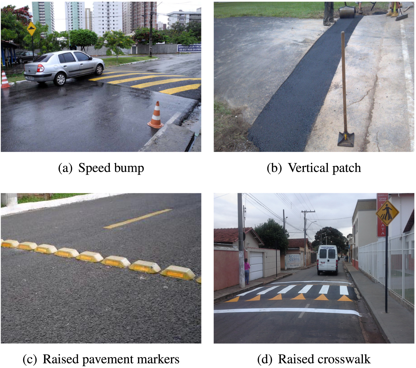
This dataset was used in [1] and donated by the authors of that paper. Accelerometer data was collected on a smartphone installed inside a vehicle using a flexible suction holder near the dashboard. An expert was responsible for driving the vehicle while the device ran an Android application called Asfault [2], developed specifically to store the current asphalt condition continuously over time. Asfault stores the time-stamp of the collected data, acceleration forces in along the three physical axes, latitude, longitude, and velocity. The acceleration forces are given by the accelerometer sensor of the device and are the data used for the classification task. Latitude, longitude, and velocity are given by the GPS and are used to locate the collected/classified data. Each one of this information is a different continuous time series. A sampling rate of 100 Hz was used for each time series. It is important to note that the Android system does not guarantee a perfect precision on the interval between readings. This means that when we choose a sampling rate of 100 Hz, the device should output between 95 and 105 observations per second. For this data, the (X,Y,Z) acceleration time series are converted into a univariate time series that represents the acceleration magnitude. In order to obtain labeled data, the Asfault application allows the expert to inform the pavement condition before collecting the data. To guarantee the integrity of data, Asfault also records videos of the road over the data collection using the built-in camera. Thus, it is possible to perform the analysis of these videos to confirm the class labels assigned by the expert. The datasets were collected in the Brazilian cities of Sao Carlos, Ribeirao Preto, Araraquara, and Maringa using a medium sized hatchback car (Hyundai i30) and two different devices (Samsung Galaxy A5 and Samsung S7). The problem AsphaltObstacles involves the identification of four common obstacles in the region of data collection. It has the following class labels:
Data is variable length, minimum 111 observations, maximum 736. The data is split randomly into 50/50 default train series. The data can be resampled without bias. The best result for the Asphalt-Obstacles dataset was achieved by DTW distance with 81.13\% accuracy (Table 9 of [1]). |