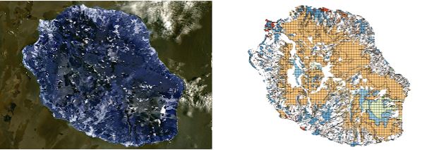
Dataset: Tiselac
| Train Size | Test Size | Length | Number of Classes | Number of Dimensions | Type |
| 81714 | 17973 | 23 | 9 | 10 | IMAGE |
| Donated By: | Martino Gonzalez, Tony Bagnall |
| Description: | TiSeLaC : Time Series Land Cover Classification Challenge
A MSTC Land Cover classification problem for data taken from the Reunion island.
(Link Here)
A case is a pixel. Measurements are taken over 23 time points
(days), with 10 dimensions: 7 surface reflectances (Ultra
Blue, Blue, Green, Red, NIR, SWIR1 and SWIR2) plus 3 indices (NDVI,
NDWI and BI).
Class values relate to one of 9 land cover types class values:
1. Urban Areas (16000 cases) 2. Other built-up surfaces (3236 cases) 3. Forests (16000 cases) 4. Sparse Vegetation (16000 cases) 5. Rocks and bare soil (12942 cases) 6. Grassland (5681 cases) 7. Sugarcane crops (7656 cases) 8. Other crops (1600 cases) 9. Water (2599 cases) The winning entry has an F score of 99.29 (not clear how this is calculated for a multi class problem). The data was formatted by Gonzalo Martinez and Tony Bagnall at UEA. |